
Retrospective
“Looking to the North” is a unique cartographic exhibition currently on display at the Polar Museum in Tromsø.
By: Henning Hansen and Per Pippin Aspaas // University Library, UiT The Arctic University of Norway
The exhibition features some of the most spectacular printed maps of the northern regions, among them a copy of the first printed map of the European Far North, published in Ulm 1482, in present-day Germany.
UiT The Arctic University of Norway boasts one of the finest collections of printed maps of the Far North, supplemented by a substantial book collection with travelogues from the northern regions. The objects on display all come from this collection.
The exhibition spans just over a century, from the late fifteenth to the early seventeenth century, a period which saw swift technological development coincide with mounting interest in the northern regions. Covering a whole room, each of the four exhibition walls marks a particular thematic or materialistic feature. The first wall addresses how the North was perceived in the medieval world and shows how the North gained new meaning in both a practical and theoretical sense as the world view shifted from being, quite literally, oriented towards the Orient, to being oriented towards the North.
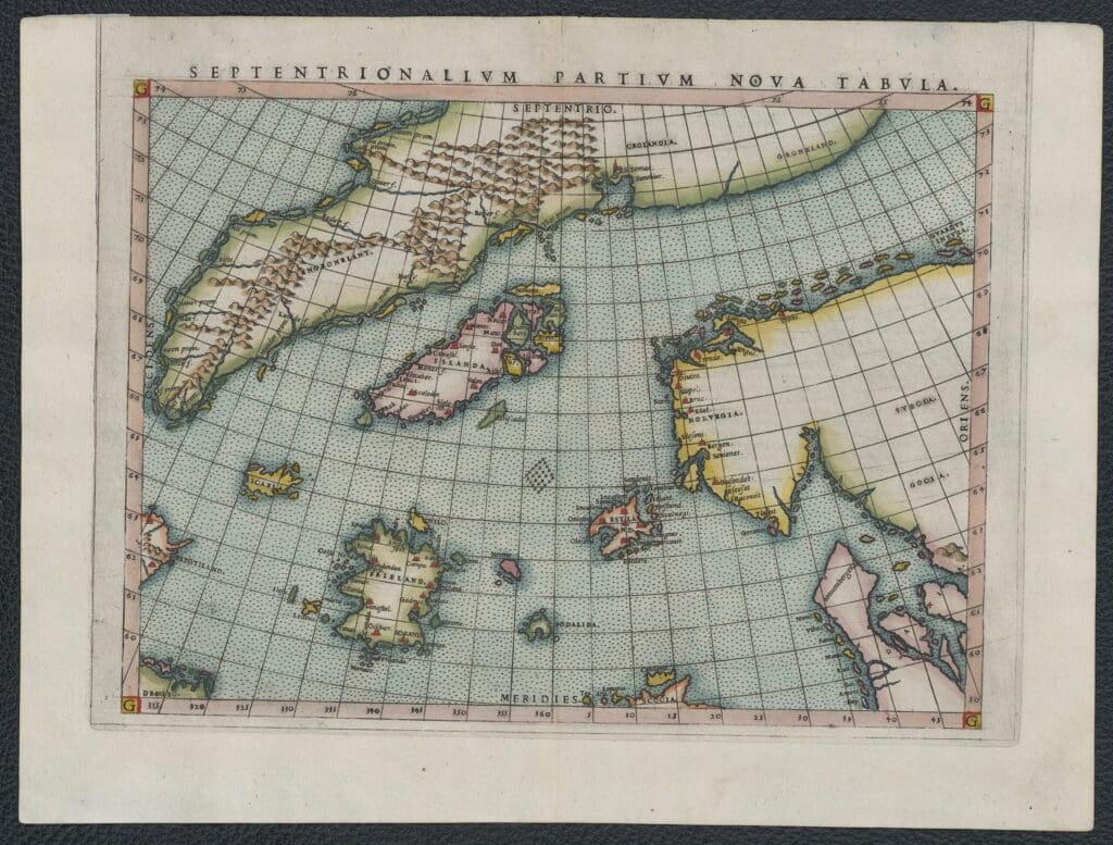
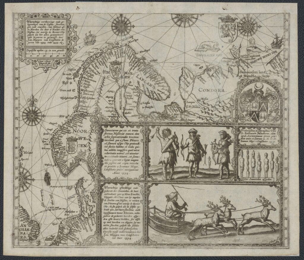
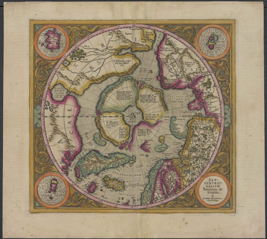
The second wall shows how the Nordic region went from being a rather unrecognisable body of land, full of uncharted territories, to becoming increasingly similar to the North as we know it today. In the earliest maps of northern Europe, the Scandinavian Peninsula is stretched from east to west rather than from south to north and it is strangely attached to Greenland.
Other factoids, such as the presence of pygmies close to the North Pole and fantastic islands scattered across the Atlantic, were deemed credible by generations of cartographers, who replicated them from map to map. Even the maps by participants in Willem Barents’ expeditions contain many mythic features, despite their first-hand experience from at least parts of the regions covered.
The entirety of the third wall is devoted to a reproduction of the Swede Olaus Magnus’ map Carta Marina, the only object on display which is not part of UiT’s map collection. Arguably the single most famous map of northern Europe, it is fascinating not just because it has only been preserved in two copies (one in Uppsala and one in Munich) but also due to its majestic size. The exact replica of the map comprises nine incredibly detailed sheets, full of wildlife, indigenous peoples and historical characters, ships, mountains, islets, and monsters.
The last wall displays a range of different maps that have one thing in common: they are all coloured by hand, with the original colours amazingly well preserved. The hand-colouring marked the final step of a map’s production, usually executed on request from the buyer of the item. Most maps were printed without any borders, which allowed the buyer to superimpose an image of the world which resonated with their own perception of it. Indeed, what the earliest phase in the history of printed maps of our region reveals is first and foremost how malleable the perceptions of the Far North were, depending on who was looking to the North, and when.